


12 Cedars of Leb. St. Park Assembly Hall Voting District, Wilson County, Tennessee
About
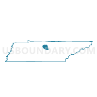
Outline

Summary
| Unique Area Identifier | 670058 |
| Name | 12 Cedars of Leb. St. Park Assembly Hall Voting District |
| County | Wilson County |
| State | Tennessee |
| Area (square miles) | 49.35 |
| Land Area (square miles) | 49.35 |
| Water Area (square miles) | 0.00 |
| % of Land Area | 99.99 |
| % of Water Area | 0.01 |
| Latitude of the Internal Point | 36.04662160 |
| Longtitude of the Internal Point | -86.35431830 |
Maps


Graphs
Select a template below for downloading or customizing gragh for 12 Cedars of Leb. St. Park Assembly Hall Voting District, Wilson County, Tennessee


Neighbors
Neighoring Voting District (by Name) Neighboring Voting District on the Map
- 02-1 Lascassas School Voting District, Rutherford County, TN
- 02-2 Walter Hill School Voting District, Rutherford County, TN
- 03-3 Wilson Elementary School Voting District, Rutherford County, TN
- 07 Southside Elementary School Voting District, Wilson County, TN
- 12 Norene Community Center Voting District, Wilson County, TN
- 13 Gladeville Elementary Voting District, Wilson County, TN
- 14 Gladeville Elementary Voting District, Wilson County, TN
Top 10 Neighboring County Subdivision (by Population) Neighboring County Subdivision on the Map
- District 2, Rutherford County, TN (12,397)
- District 3, Rutherford County, TN (12,027)
- District 13, Wilson County, TN (4,565)
- District 12, Wilson County, TN (4,181)
- District 7, Wilson County, TN (4,044)
- District 14, Wilson County, TN (3,895)
Top 10 Neighboring Unified School District (by Population) Neighboring Unified School District on the Map
Top 10 Neighboring State Legislative District Lower Chamber (by Population) Neighboring State Legislative District Lower Chamber on the Map
- State House District 57, TN (84,276)
- State House District 49, TN (81,804)
- State House District 48, TN (75,364)
- State House District 46, TN (68,934)
Top 10 Neighboring State Legislative District Upper Chamber (by Population) Neighboring State Legislative District Upper Chamber on the Map
Top 10 Neighboring 111th Congressional District (by Population) Neighboring 111th Congressional District on the Map
Top 10 Neighboring Census Tract (by Population) Neighboring Census Tract on the Map
- Census Tract 405.01, Rutherford County, TN (6,989)
- Census Tract 405.02, Rutherford County, TN (6,609)
- Census Tract 309.03, Wilson County, TN (6,081)
- Census Tract 308, Wilson County, TN (5,787)
- Census Tract 309.04, Wilson County, TN (3,523)